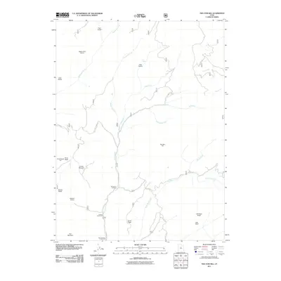
2011 Map of Two Tom Hill
USGS Topo · Published 2011About this map
Diamond Fork carves through this portion of Utah County, serving as a primary drainage for a landscape defined by narrow canyons and high ridges. The map illustrates a concentration of recreation and transit along the river valley at Springville Crossings, where Grays Valley Rd meets the water. To the south, Hawthorn Campground and Mineral Spring Campground indicate the area's long-standing use for mountain access and outdoor relief.
Find a feature on this map
30 named features on this map. Tap any name to fly to it.
Don’t see what you’re looking for? This feature index may not catch every label — zoom into the map to look around manually.
Map Details
Editions of this 2011 Two Tom Hill Map
This is the sole edition of this map. No revisions or reprints were ever made.
Other maps of this area

1885 · Salt Lake
USGS Topo · 1:250,000

1907 · Strawberry Valley
USGS Topo · 1:125,000

1909 · Strawberry Valley
USGS Topo · 1:125,000

1954 · Salt Lake City
USGS Topo · 1:250,000

1958 · Salt Lake City
USGS Topo · 1:250,000

1960 · Salt Lake City
USGS Topo · 1:250,000

1966 · Strawberry Reservoir NW
USGS Topo · 1:24,000
1966 · Strawberry Reservoir SW
USGS Topo · 1:24,000

1967 · Two Tom Hill
USGS Topo · 1:24,000
1967 · Granger Mtn
USGS Topo · 1:24,000