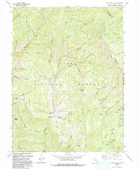
1993 Map of Two Tom Hill
USGS Topo · Published 1994About this map
Uinta National Forest lands dominate this mountain landscape, which was revised in the early 1990s from aerial photography and field checks. The area is defined by a dense network of watercourses and ridges, including the prominent Strawberry Ridge and the Diamond Fork drainage. At Springville Crossing, a local hub of activity emerges near the Diamond Fork Guard Station, while the higher elevations feature distinctive landmarks like Two Tom Hill and Mollies Nipple. Evidence of infrastructure and resource management is visible through labels for a Tunnel (Under Construction) near Fifth Water, and the legacy of early industry is preserved in place names such as Sawmill Hollow and Shingle Mill. The map documents a rugged interior Utah territory characterized by numerous natural springs like Graveyard Spring and Mud Spring, along with several Pack Trails that provided access through the deep canyons and steep slopes.
Find a feature on this map
58 named features on this map. Tap any name to fly to it.
Don’t see what you’re looking for? This feature index may not catch every label — zoom into the map to look around manually.
Map Details
Editions of this 1993 Two Tom Hill Map
This is the sole edition of this map. No revisions or reprints were ever made.
Other maps of this area

1885 · Salt Lake
USGS Topo · 1:250,000

1907 · Strawberry Valley
USGS Topo · 1:125,000

1909 · Strawberry Valley
USGS Topo · 1:125,000

1954 · Salt Lake City
USGS Topo · 1:250,000

1958 · Salt Lake City
USGS Topo · 1:250,000

1960 · Salt Lake City
USGS Topo · 1:250,000

1966 · Strawberry Reservoir NW
USGS Topo · 1:24,000
1966 · Strawberry Reservoir SW
USGS Topo · 1:24,000

1967 · Two Tom Hill
USGS Topo · 1:24,000
1967 · Granger Mtn
USGS Topo · 1:24,000