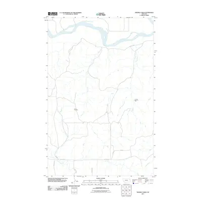
2011 Map of Twomile Creek
USGS Topo · Published 2011About this map
The Missouri River carves a sweeping path across the northern reaches of this landscape, defining the hydrology of the Fort Kipp District in northeastern Montana. This early 21st-century perspective reveals a rural terrain where water management is critical to local land use, evidenced by features such as Juniors Place Dam and the C Sowle Reservoir Dam. These small-scale structures suggest a continuing reliance on reservoir systems to support the arid prairie environment. Multiple drainages including Cedar Creek, Twomile Creek, and Charley Creek flow toward the Missouri, creating a network of coulees and breaks. The infrastructure is primarily composed of a grid-like system of secondary routes, such as County Rd 146 and County Rd 327, which provide access across the high plains and connect various agricultural or ranching tracts within the quadrangle.
Find a feature on this map
16 named features on this map. Tap any name to fly to it.
Don’t see what you’re looking for? This feature index may not catch every label — zoom into the map to look around manually.
Map Details
Editions of this 2011 Twomile Creek Map
This is the sole edition of this map. No revisions or reprints were ever made.
Other maps of this area

1909 · Glendive
USGS Topo · 1:250,000

1914 · Brockton
USGS Topo · 1:62,500

1948 · Fort Kipp
USGS Topo · 1:24,000

1949 · Fort Kipp
USGS Topo · 1:24,000

1950 · Calais
USGS Topo · 1:24,000

1954 · Glendive
USGS Topo · 1:250,000

1954 · Wolf Point
USGS Topo · 1:250,000

1957 · Glendive
USGS Topo · 1:250,000

1958 · Wolf Point
USGS Topo · 1:250,000

1958 · Glendive
USGS Topo · 1:250,000