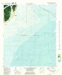
1979 Map of Tybee Island South
USGS Topo · Published 1979About this map
Tybee Island meets the sea in this 1970s orthophotomap, which uniquely blends aerial photography with bathymetric data to chart the changing Georgia coastline. The map documents significant coastal engineering efforts of the era, specifically noting the Beach Renourished-1976 zone along the oceanfront. This hybrid survey provides a rare look at the underwater topography of the Atlantic Ocean alongside the terrestrial features of the South End and the adjacent marshlands. Dense residential patterns on the main island contrast with the undeveloped stretches of Little Tybee Island and interior high ground like Spanish Hammock and Horse Hammock. Coastal dynamics are highlighted by notes on areas subject to frequent change and the winding course of Tybee Creek, offering a precise record of the shoreline before decades of subsequent storms and tidal shifts.
Find a feature on this map
11 named features on this map. Tap any name to fly to it.
Don’t see what you’re looking for? This feature index may not catch every label — zoom into the map to look around manually.
Map Details
Editions of this 1979 Tybee Island South Map
2 editions found
Other maps of this area

1920 · Wassaw Sound
USGS Topo · 1:62,500

1920 · Hilton Head
USGS Topo · 1:62,500

1920 · Bluffton
USGS Topo · 1:62,500

1945 · Bluffton
USGS Topo · 1:62,500

1945 · Hilton Head
USGS Topo · 1:62,500

1945 · Wassaw Sound
USGS Topo · 1:62,500

1946 · Brunswick
USGS Topo · 1:250,000

1947 · Savannah
USGS Topo · 1:250,000

1948 · Brunswick
USGS Topo · 1:250,000

1948 · Savannah
USGS Topo · 1:250,000