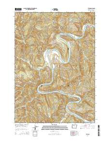
2014 Map of Tyee
USGS Topo · Published 2014About this map
The Umpqua River carves a dramatic, winding path through this Douglas County landscape, creating sharp meanders and prominent features like Baskett Point and Powell Bar. This 2014 survey captures the small settlements of Tyee and Millwood, illustrating a rural pattern where development is largely dictated by the river’s course and the steep elevations of Case Knife Ridge and Rattlesnake Ridge. The map shows a network of logging and access roads, including Wolf Creek Rd and Tyee Rd, which navigate the many drainages feeding into the main channel, such as Hubbard Creek and Wolf Cr. Small water bodies like the Rinaldi Reservoir and Beaver Pond are tucked into the drainages, reflecting the localized water management and natural hydrology of this timber-rich region.
Find a feature on this map
44 named features on this map. Tap any name to fly to it.
Don’t see what you’re looking for? This feature index may not catch every label — zoom into the map to look around manually.
Map Details
Editions of this 2014 Tyee Map
This is the sole edition of this map. No revisions or reprints were ever made.
Other maps of this area

1897 · Roseburg
USGS Topo · 1:125,000

1900 · Roseburg
USGS Topo · 1:125,000

1928 · Sitkum
USGS Topo · 1:125,000

1954 · Sutherlin
USGS Topo · 1:62,500

1954 · Drain
USGS Topo · 1:62,500

1955 · Tyee
USGS Topo · 1:62,500

1955 · Elkton
USGS Topo · 1:62,500

1958 · Roseburg
USGS Topo · 1:250,000

1959 · Roseburg
USGS Topo · 1:250,000

1979 · Roseburg
USGS Topo · 1:100,000