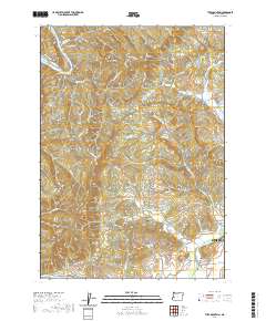
2020 Map of Tyee Mountain
USGS Topo · Published 2020About this map
Sutherlin and the small settlement of Stephens anchor the southeastern corner of this Douglas County landscape, where the flat valley floor meets the complex ridges of the Oregon Coast Range. The Umpqua River snakes across the southwestern corner, while north of the valley, the terrain is defined by prominent elevations such as Tyee Mtn and Yellow Creek Mtn. These peaks are separated by deep drainages like Galagher Canyon and the aptly named Little Canyon. Local history is preserved in sites like the Tyee View Cem and the Hurst Family Cem, alongside landmarks such as Bullock Bridge. The map details a network of timber and ranching access roads, including Spooner Rdg and Green Valley Rd, which navigate the steep transition from the Calapooya Creek basin into the higher timberlands of the t24s r7w township.
Find a feature on this map
69 named features on this map. Tap any name to fly to it.
Don’t see what you’re looking for? This feature index may not catch every label — zoom into the map to look around manually.
Map Details
Editions of this 2020 Tyee Mountain Map
This is the sole edition of this map. No revisions or reprints were ever made.
Other maps of this area

1897 · Roseburg
USGS Topo · 1:125,000

1900 · Roseburg
USGS Topo · 1:125,000

1928 · Sitkum
USGS Topo · 1:125,000

1954 · Sutherlin
USGS Topo · 1:62,500

1954 · Drain
USGS Topo · 1:62,500

1955 · Tyee
USGS Topo · 1:62,500

1955 · Elkton
USGS Topo · 1:62,500

1958 · Roseburg
USGS Topo · 1:250,000

1959 · Roseburg
USGS Topo · 1:250,000

1979 · Roseburg
USGS Topo · 1:100,000