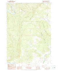
1987 Map of Tyee Mountain
USGS Topo · Published 1987About this map
The Umpqua River carves through the northwestern reaches of this Douglas County landscape, serving as a primary corridor for the Tyee Recreation Area and the small settlement at Camp Tyee. The terrain is defined by a series of prominent rises including Tyee Mountain and Gross Mountain, separated by deep drainage basins like Green Valley and Dodge Canyon Creek. Evidence of local infrastructure is seen in the Bullock Bridge and a network of 4wd tracks that penetrate the more remote ridges such as Spooner Ridge and Galagher Ridge. To the south, the settlement of Stephens and a local Cem lie near the banks of Calapooya Creek, where the land begins to level out for agricultural or residential use. The presence of a Quarry and various powerlines suggests an era of resource management and rural utility development in the mid-1980s.
Find a feature on this map
27 named features on this map. Tap any name to fly to it.
Don’t see what you’re looking for? This feature index may not catch every label — zoom into the map to look around manually.
Map Details
Editions of this 1987 Tyee Mountain Map
This is the sole edition of this map. No revisions or reprints were ever made.
Other maps of this area

1897 · Roseburg
USGS Topo · 1:125,000

1900 · Roseburg
USGS Topo · 1:125,000

1928 · Sitkum
USGS Topo · 1:125,000

1954 · Sutherlin
USGS Topo · 1:62,500

1954 · Drain
USGS Topo · 1:62,500

1955 · Tyee
USGS Topo · 1:62,500

1955 · Elkton
USGS Topo · 1:62,500

1958 · Roseburg
USGS Topo · 1:250,000

1959 · Roseburg
USGS Topo · 1:250,000

1979 · Roseburg
USGS Topo · 1:100,000