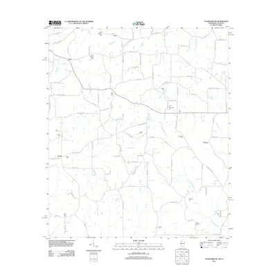
2012 Map of Tylertown SE
USGS Topo · Published 2012About this map
Elisha Crawford Holmes Cem and Elisha Holmes Senior Cem anchor the northern landscape of this rural region, highlighting the deep family heritage along the Mississippi-Louisiana border. Small agricultural and residential clusters like Carto, Davo, and Kirklin are connected by a network of local roads including Pushapatapa Rd and Larry Warren Rd. The terrain is defined by the winding paths of the W Fork Pushepatapa Cr and E Fork Pushepatapa Cr, which drain the timbered and farm-heavy bottomlands. Numerous family and community burial grounds, such as the Sam McKenzie Cem, Jessie C Fortenberry Cem, and State Line Cem, are scattered throughout the quadrangle, serving as vital landmarks for genealogists tracing the legacy of Walthall County and northern Washington Parish.
Find a feature on this map
95 named features on this map. Tap any name to fly to it.
Don’t see what you’re looking for? This feature index may not catch every label — zoom into the map to look around manually.
Map Details
Editions of this 2012 Tylertown SE Map
This is the sole edition of this map. No revisions or reprints were ever made.
Other maps of this area

1939 · Clifton
USGS Topo · 1:31,680

1942 · Thomas
USGS Topo · 1:31,680

1950 · Crains Creek
USGS Topo · 1:31,680

1953 · Hattiesburg
USGS Topo · 1:250,000

1953 · Natchez
USGS Topo · 1:250,000

1953 · Mobile
USGS Topo · 1:250,000

1954 · Baton Rouge
USGS Topo · 1:250,000

1956 · Natchez
USGS Topo · 1:250,000

1956 · Baton Rouge
USGS Topo · 1:250,000

1957 · Mobile
USGS Topo · 1:250,000