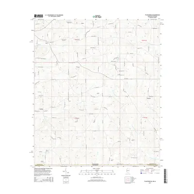
2015 Map of Tylertown SE
USGS Topo · Published 2015About this map
The Mississippi-Louisiana state line defines the southern edge of this landscape, where Walthall County meets Washington Parish. Small settlements like Kirklin and Flowers anchor a rural interior networked by numerous family-named roads, including Walt Brock Rd, Art Blackwell Rd, and Sam Thomas Rd. The terrain is deeply tied to its genealogical heritage, evidenced by the high density of family burial grounds such as the Elisha Crawford Holmes Cem and Sam McKenzie Cem. The hydrologic pattern is shaped by the parallel south-flowing branches of W Fork Pushepatapa Cr and E Fork Pushepatapa Cr, which drain the low rises between Carto and the southern boundary. These creeks, along with Bayou Beth near the Old State Line Cem, influenced the placement of early homesteads and cemeteries throughout the early 21st century.
Find a feature on this map
83 named features on this map. Tap any name to fly to it.
Don’t see what you’re looking for? This feature index may not catch every label — zoom into the map to look around manually.
Map Details
Editions of this 2015 Tylertown SE Map
This is the sole edition of this map. No revisions or reprints were ever made.
Other maps of this area

1939 · Clifton
USGS Topo · 1:31,680

1942 · Thomas
USGS Topo · 1:31,680

1950 · Crains Creek
USGS Topo · 1:31,680

1953 · Hattiesburg
USGS Topo · 1:250,000

1953 · Natchez
USGS Topo · 1:250,000

1953 · Mobile
USGS Topo · 1:250,000

1954 · Baton Rouge
USGS Topo · 1:250,000

1956 · Natchez
USGS Topo · 1:250,000

1956 · Baton Rouge
USGS Topo · 1:250,000

1957 · Mobile
USGS Topo · 1:250,000