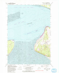
1979 Map of Tyonek A-1 NE
USGS Topo · Published 1993About this map
Knik Arm and Turnagain Arm converge in this detailed mapping of the Anchorage coastline as it appeared in the late 1970s, with revisions through the early 1990s. The landscape is defined by its strategic infrastructure and massive intertidal zones, including North Point Shoal and Woronzof Shoal. The western edge of the city is anchored by the sprawling Anchorage International Airport, while the coast is preserved through the Anchorage Coastal State Wildlife Refuge and the extensive Tony Knowles Coastal Trail. The inclusion of Fire Island to the west, featuring a landing strip and radio facility, highlights the area's importance for regional aviation and navigation. On the mainland, Campbell-Kincaid Park provides a significant recreational buffer between the airport and the residential corridors along Jodhpur Street and Dimond Blvd.
Find a feature on this map
28 named features on this map. Tap any name to fly to it.
Don’t see what you’re looking for? This feature index may not catch every label — zoom into the map to look around manually.
Map Details
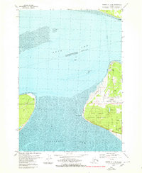
Editions of this 1979 Tyonek A-1 NE Map
2 editions found
Other maps of this area

1949 · Tyonek
USGS Topo · 1:250,000

1951 · Anchorage
USGS Topo · 1:250,000

1951 · Tyonek
USGS Topo · 1:250,000

1951 · Tyonek A-1
USGS Topo · 1:63,360

1952 · Tyonek A-1
USGS Topo · 1:63,360

1952 · Anchorage A-8
USGS Topo · 1:63,360

1952 · Anchorage B-8
USGS Topo · 1:63,360

1953 · Anchorage A-8
USGS Topo · 1:63,360

1953 · Anchorage B-8
USGS Topo · 1:63,360

1958 · Tyonek B-1
USGS Topo · 1:63,360