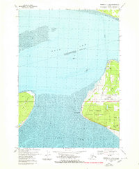
1979 Map of Tyonek A-1 NE
USGS Topo · Published 1980About this map
Knik Arm and Turnagain Arm converge in this detailed look at the western edge of the Anchorage peninsula in the late 1970s. The landscape is defined by the significant infrastructure of Anchorage International Airport and the expansive Point Campbell Military Reservation. To the west, across the mudflats, lies Fire Island, featuring its own Landing Strip and North Point.
Find a feature on this map
25 named features on this map. Tap any name to fly to it.
Don’t see what you’re looking for? This feature index may not catch every label — zoom into the map to look around manually.
Map Details
Editions of this 1979 Tyonek A-1 NE Map
2 editions found
Other maps of this area

1949 · Tyonek
USGS Topo · 1:250,000

1951 · Anchorage
USGS Topo · 1:250,000

1951 · Tyonek
USGS Topo · 1:250,000

1951 · Tyonek A-1
USGS Topo · 1:63,360

1952 · Tyonek A-1
USGS Topo · 1:63,360

1952 · Anchorage A-8
USGS Topo · 1:63,360

1952 · Anchorage B-8
USGS Topo · 1:63,360

1953 · Anchorage A-8
USGS Topo · 1:63,360

1953 · Anchorage B-8
USGS Topo · 1:63,360

1958 · Tyonek B-1
USGS Topo · 1:63,360