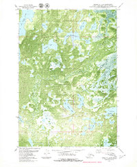
1979 Map of Tyonek C-1 SE
USGS Topo · Published 1980About this map
Nancy Lake State Recreation Area dominates this subarctic landscape in the Matanuska-Susitna Borough, where an intricate network of glacial lakes and wetlands is defined by the wandering course of the Little Susitna River. This orthophotomap, based on 1974 photography, reveals the dense vegetation and hydrography of the region during a period of expanding recreational infrastructure. Notable water bodies include the large Red Shirt Lake and the interconnected Papoose Twins Lake, Buckley Lake No 1, and Butterfly Lake. Remote access is indicated by a Winter Trail and a designated Landing Strip, highlighting the reliance on seasonal routes and bush aviation. Smaller features like Freundly Island and Pleasure Island suggest the early development of local recreational sites amidst the wilderness terrain.
Find a feature on this map
26 named features on this map. Tap any name to fly to it.
Don’t see what you’re looking for? This feature index may not catch every label — zoom into the map to look around manually.
Map Details
Editions of this 1979 Tyonek C-1 SE Map
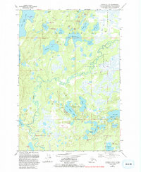
2 editions found
Other maps of this area

1949 · Tyonek
USGS Topo · 1:250,000

1950 · Anchorage C-8
USGS Topo · 1:63,360

1951 · Anchorage
USGS Topo · 1:250,000

1951 · Tyonek
USGS Topo · 1:250,000

1952 · Anchorage C-8
USGS Topo · 1:63,360

1952 · Tyonek C-1
USGS Topo · 1:63,360

1952 · Anchorage B-8
USGS Topo · 1:63,360

1953 · Anchorage B-8
USGS Topo · 1:63,360

1958 · Tyonek B-1
USGS Topo · 1:63,360

1958 · Tyonek C-1
USGS Topo · 1:63,360