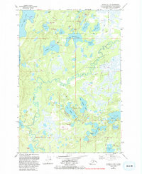
1979 Map of Tyonek C-1 SE
USGS Topo · Published 1993About this map
Nancy Lake State Recreation Area dominates this section of the Matanuska-Susitna Borough, revealing a complex glacial landscape defined by hundreds of small lakes and interconnected wetlands. The meandering path of the Little Susitna River cuts through the center of the sheet, surrounded by low-lying tracts and winter trails that suggest the seasonal nature of travel in this subarctic environment. Large water bodies like Red Shirt Lake and Butterfly Lake are accompanied by smaller, descriptively named features such as the Papoose Twins and Two Loon Lake. Human presence is minimal but strategically placed, with a Landing Strip and the Big Lake Road providing the primary access points to this wilderness. Evidence of local industry and recreation is found in the Gravel Pit near Diamond Lake and the naming of Pleasure Island within Flat Lake.
Find a feature on this map
49 named features on this map. Tap any name to fly to it.
Don’t see what you’re looking for? This feature index may not catch every label — zoom into the map to look around manually.
Map Details
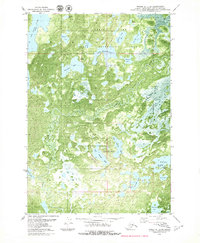
Editions of this 1979 Tyonek C-1 SE Map
2 editions found
Other maps of this area

1949 · Tyonek
USGS Topo · 1:250,000

1950 · Anchorage C-8
USGS Topo · 1:63,360

1951 · Anchorage
USGS Topo · 1:250,000

1951 · Tyonek
USGS Topo · 1:250,000

1952 · Anchorage C-8
USGS Topo · 1:63,360

1952 · Tyonek C-1
USGS Topo · 1:63,360

1952 · Anchorage B-8
USGS Topo · 1:63,360

1953 · Anchorage B-8
USGS Topo · 1:63,360

1958 · Tyonek B-1
USGS Topo · 1:63,360

1958 · Tyonek C-1
USGS Topo · 1:63,360