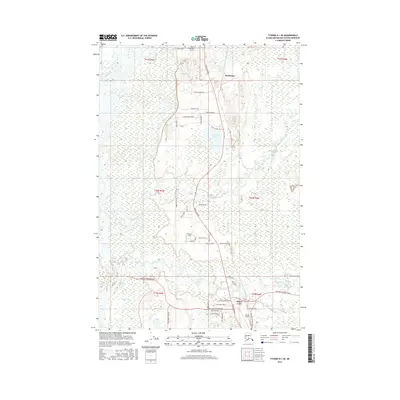
2016 Map of Tyonek D-1 SE
USGS Topo · Published 2016About this map
The Susitna River forms a dominant braided waterway along the western edge of this Matanuska-Susitna region, where the Parks Highway serves as the primary artery for development. The landscape is characterized by a transition from the river's alluvial plain to a network of lakes and creeks, including Kashwitna Lake and Willow Lake. Aviation is central to the area's accessibility, evidenced by Willow Airport and the Rustic Wilderness Airport near the settlement of Kashwitna. Local road names like Lucky Shot Trail and Willow Station Road reflect a history of mining access and transport. Residential pockets and small settlements such as Thomas Strip are clustered near water bodies like Willow Creek, while the eastern portion remains dominated by smaller drainages such as Rogers Cr and Iron Cr. This survey illustrates the intricate balance between modern infrastructure and the expansive hydrological systems of South-Central Alaska.
Find a feature on this map
50 named features on this map. Tap any name to fly to it.
Don’t see what you’re looking for? This feature index may not catch every label — zoom into the map to look around manually.
Map Details
Editions of this 2016 Tyonek D-1 SE Map
This is the sole edition of this map. No revisions or reprints were ever made.
Other maps of this area

1949 · Tyonek
USGS Topo · 1:250,000

1949 · Anchorage D-8
USGS Topo · 1:63,360

1950 · Anchorage C-8
USGS Topo · 1:63,360

1951 · Anchorage
USGS Topo · 1:250,000

1951 · Tyonek
USGS Topo · 1:250,000

1951 · Anchorage D-8
USGS Topo · 1:63,360

1952 · Anchorage C-8
USGS Topo · 1:63,360

1952 · Tyonek D-1
USGS Topo · 1:63,360

1952 · Tyonek C-1
USGS Topo · 1:63,360

1952 · Anchorage D-8
USGS Topo · 1:63,360