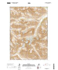
2017 Map of Tyonek D-8 NW
USGS Topo · Published 2017About this map
Cathedral Mtn and Mt Stoney dominate this high-elevation Alaskan terrain within the Matanuska-Susitna Borough. This 2017 survey details a landscape defined by extreme topographic relief, where the steep slopes of the Alaska Range are punctuated by significant natural corridors like Portage Pass. The map highlights the drainage patterns of Portage Cr, providing a technical look at the remote wilderness north of Tyonek. Researchers and outdoorsmen can utilize the precise contour intervals to trace the specific geographic boundaries of t22n r20w and t21n r20w, offering an essential record of this undeveloped region's natural features.
Find a feature on this map
8 named features on this map. Tap any name to fly to it.
Don’t see what you’re looking for? This feature index may not catch every label — zoom into the map to look around manually.
Map Details
Editions of this 2017 Tyonek D-8 NW Map
This is the sole edition of this map. No revisions or reprints were ever made.
Other maps of this area

1949 · Tyonek
USGS Topo · 1:250,000

1949 · McGrath
USGS Topo · 1:250,000

1950 · McGrath
USGS Topo · 1:250,000

1950 · Talkeetna
USGS Topo · 1:250,000

1951 · Talkeetna
USGS Topo · 1:250,000

1951 · Tyonek
USGS Topo · 1:250,000

1951 · Lime Hills
USGS Topo · 1:250,000

1958 · Talkeetna A-6
USGS Topo · 1:63,360

1958 · McGrath A-1
USGS Topo · 1:63,360

1958 · Tyonek D-8
USGS Topo · 1:63,360