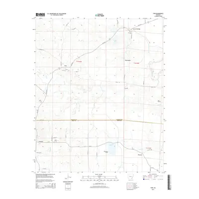
2014 Map of Tyro
USGS Topo · Published 2014About this map
The boundary between Lincoln and Drew Counties divides this section of Southeast Arkansas, where the landscape transitions from the winding course of Bayou Bartholomew to the open flats of Touchstone Prairie. The settlement of Tyro serves as a local hub near the headwaters of Ables Creek, while small rural communities like Coleman, Florence, and Warrenton are connected by a network of backroads such as German Road and Maplewood Road. Genealogists will find several notable burial sites scattered across the townships, including Tyro Cemetery and Oak Grove Cemetery. The terrain is characterized by its drainage patterns, with numerous tributaries like Weaver Creek and Panther Creek feeding into the larger bayou system. Notable landmarks such as Twin Mounds and Garrett Bridge further distinguish this agricultural and timber-rich region as it appeared in the early 21st century.
Find a feature on this map
46 named features on this map. Tap any name to fly to it.
Don’t see what you’re looking for? This feature index may not catch every label — zoom into the map to look around manually.
Map Details
Editions of this 2014 Tyro Map
This is the sole edition of this map. No revisions or reprints were ever made.
Other maps of this area

1935 · Feenyville
USGS Topo · 1:62,500

1935 · Cominto
USGS Topo · 1:62,500

1935 · Rotan
USGS Topo · 1:62,500

1953 · Greenwood
USGS Topo · 1:250,000

1956 · Greenwood
USGS Topo · 1:250,000

1960 · Selma
USGS Topo · 1:24,000

1960 · Collins NW
USGS Topo · 1:24,000

1960 · Collins
USGS Topo · 1:62,500
1964 · Avery
USGS Topo · 1:24,000
1964 · Gourd
USGS Topo · 1:24,000