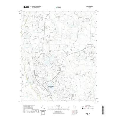
2020 Map of Tyrone
USGS Topo · Published 2020About this map
Peachtree City and Tyrone anchor this detailed 2020 landscape, where suburban expansion meets long-standing rural landmarks. The survey documents the complex network of neighborhoods organized around water bodies like Lake Peachtree, Lake Tyrone, and Adams Lake. A distinct history is visible in the distribution of family and community burial grounds, including Old Flat Creek Cem, Palmer Cem, and the Line Creek Cem located near the southwestern boundary.
Find a feature on this map
310 named features on this map. Tap any name to fly to it.
Don’t see what you’re looking for? This feature index may not catch every label — zoom into the map to look around manually.
Map Details
Editions of this 2020 Tyrone Map
This is the sole edition of this map. No revisions or reprints were ever made.
Other maps of this area

1888 · Atlanta
USGS Topo · 1:125,000

1890 · Atlanta
USGS Topo · 1:125,000

1891 · Marietta
USGS Topo · 1:125,000

1892 · Atlanta
USGS Topo · 1:125,000

1895 · Atlanta
USGS Topo · 1:125,000

1895 · Marietta
USGS Topo · 1:125,000

1897 · Marietta
USGS Topo · 1:125,000

1901 · Marietta
USGS Topo · 1:125,000

1953 · Atlanta
USGS Topo · 1:250,000

1954 · Palmetto
USGS Topo · 1:24,000