2024 Map of Tyrone
USGS Topo · Published 2024About this map
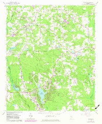
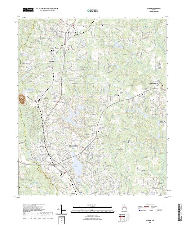
Peachtree City and Tyrone anchor this detailed study of the suburbanizing landscape in western Georgia. The survey documents a complex network of residential developments and water features, including the central Lake Peachtree and smaller basins like Lake Tyrone and Lake Edith. Cultural landmarks are densely plotted, with numerous historic burial grounds such as Old Liberty Hill Cem and the Ellison Family Cem persisting amidst modern infrastructure. The map traces the corridor of the Joel Cowan Pkwy and highlights localized areas like Aberdeen and Shakerag. Natural topography is defined by the drainages of Line Creek and Flat Creek, while higher ground is marked at Berry Hill. This documentation serves as an essential record of modern Fayette County, showing the intersection of historical family sites and rapid contemporary growth.
Find a feature on this map
318 named features on this map. Tap any name to fly to it.
Don’t see what you’re looking for? This feature index may not catch every label — zoom into the map to look around manually.
Map Details
Editions of this 2024 Tyrone Map
This is the sole edition of this map. No revisions or reprints were ever made.