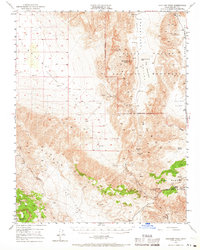
1950 Map of Ubehebe Peak
USGS Topo · Published 1966About this map
Ubehebe Peak dominates this 1950s terrain of Inyo County, anchoring a landscape defined by the mining extraction and geological oddities within Death Valley National Monument. The map documents a significant era of desert prospecting, where remote operations like the Ubehebe Mine, Lost Burro Mine, and Lippincott Lead Mine relied on isolated water sources such as Spanish Spring and Big Dodd Spr. The presence of Lee Pump and Blackrock Well further illustrates the critical infrastructure required for survival and industry in this arid environment.
Find a feature on this map
36 named features on this map. Tap any name to fly to it.
Don’t see what you’re looking for? This feature index may not catch every label — zoom into the map to look around manually.
Map Details
Editions of this 1950 Ubehebe Peak Map
3 editions found
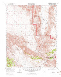
Other maps of this area

1908 · Ballarat
USGS Topo · 1:250,000

1913 · Ballarat
USGS Topo · 1:250,000

1948 · Death Valley
USGS Topo · 1:250,000

1950 · Darwin
USGS Topo · 1:62,500

1950 · New York Butte
USGS Topo · 1:62,500

1950 · Ubehebe Peak
USGS Topo · 1:62,500

1951 · New York Butte
USGS Topo · 1:62,500

1951 · Darwin
USGS Topo · 1:62,500

1951 · Ubehebe Peak
USGS Topo · 1:62,500

1951 · Panamint Butte
USGS Topo · 1:62,500