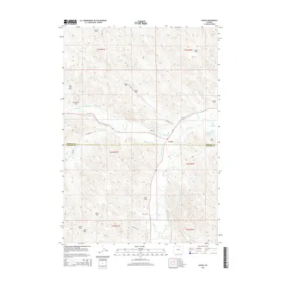
2015 Map of Ucross
USGS Topo · Published 2015About this map
Clear Creek and Piney Creek converge near the settlement of Ucross, forming a central water hub in this portion of the Powder River Basin. The landscape is defined by an extensive network of irrigation infrastructure, including the Big Bonanza Ditch, Dunlap Ditch, and Pratt and Ferris Ditch Number 1, which divert water to support ranching across the Sheridan and Johnson County line. This 2015 survey illustrates how traditional water rights and land management continue to shape the terrain, with family-named landmarks like Blazer Hill and numerous draws such as Butterfield Draw and Regina Draw scoring the high ground.
Find a feature on this map
41 named features on this map. Tap any name to fly to it.
Don’t see what you’re looking for? This feature index may not catch every label — zoom into the map to look around manually.
Map Details
Editions of this 2015 Ucross Map
This is the sole edition of this map. No revisions or reprints were ever made.
Other maps of this area

1900 · Fort McKinney
USGS Topo · 1:125,000

1903 · Fort McKinney
USGS Topo · 1:125,000

1909 · Sheridan
USGS Topo · 1:125,000

1911 · Sheridan
USGS Topo · 1:125,000

1955 · Sheridan
USGS Topo · 1:250,000

1958 · Sheridan
USGS Topo · 1:250,000

1962 · Sheridan
USGS Topo · 1:250,000

1970 · Buffalo NE
USGS Topo · 1:24,000
1970 · Horse Hill
USGS Topo · 1:24,000
1970 · Verona
USGS Topo · 1:24,000