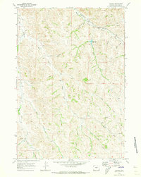
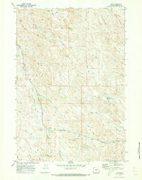
1970 Map of Verona
USGS Topo · Published 1973About this map
The northern Wyoming landscape near Verona is defined by a dense network of intermittent watercourses and draws that carve through the Sheridan County terrain. By 1970, the region’s development remained concentrated along the Burlington Northern railroad corridor, where the Ulm Road follows the path of the Dutch Creek valley. Local education is anchored at the Dutch Creek Sch, serving a community of scattered ranches and family-named landmarks like the settlement of Tibbets and Tibbetts Gulch. The reliance on water management in this environment is evident through features such as the Burlington Reservoir and numerous springs that feed into the complex drainage systems of Beaver Creek and the Middle Fork. This survey documents a ranching landscape where local geography is marked by historic pathways like the Jeep Trail and naming traditions found in Dead Indian Draw and Stout Draw.
Find a feature on this map
28 named features on this map. Tap any name to fly to it.
Don’t see what you’re looking for? This feature index may not catch every label — zoom into the map to look around manually.
Map Details
Editions of this 1970 Verona Map
This is the sole edition of this map. No revisions or reprints were ever made.
Other maps of this area

1909 · Sheridan
USGS Topo · 1:125,000

1911 · Sheridan
USGS Topo · 1:125,000

1955 · Sheridan
USGS Topo · 1:250,000

1958 · Sheridan
USGS Topo · 1:250,000

1962 · Sheridan
USGS Topo · 1:250,000

1967 · Buffalo Run Creek
USGS Topo · 1:24,000
1967 · Banner
USGS Topo · 1:24,000
1968 · Wyarno
USGS Topo · 1:24,000
1970 · Horse Hill
USGS Topo · 1:24,000
1970 · Ulm
USGS Topo · 1:24,000