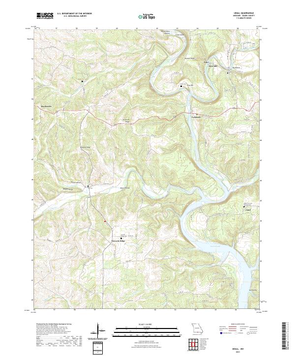
2021 Map of Udall
USGS Topo · Published 2021About this map
The confluence of Bryant Creek and the North Fork River anchors this landscape in the Missouri Ozarks, marking the northern reach of Norfork Lake. The river system defines the settlement patterns here, with Tecumseh situated at the meeting of these major waterways. To the north, the historic site of Dawt Mill stands near Dawt, representing the long-standing water-powered industry of the region.
Find a feature on this map
81 named features on this map. Tap any name to fly to it.
Don’t see what you’re looking for? This feature index may not catch every label — zoom into the map to look around manually.
Map Details
Editions of this 2021 Udall Map
This is the sole edition of this map. No revisions or reprints were ever made.
Other maps of this area

1890 · Mountain Home
USGS Topo · 1:125,000

1891 · Mountain Home
USGS Topo · 1:125,000

1894 · Mountain Home
USGS Topo · 1:125,000

1934 · Gainesville
USGS Topo · 1:48,000

1940 · Gainesville
USGS Topo · 1:62,500

1944 · Cureall
USGS Topo · 1:62,500

1945 · Harrison
USGS Topo · 1:250,000

1946 · Cureall
USGS Topo · 1:62,500

1949 · Harrison
USGS Topo · 1:250,000

1954 · Harrison
USGS Topo · 1:250,000