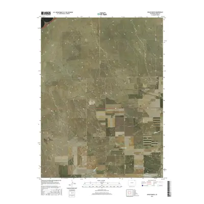
2016 Map of Uhler Ranch
USGS Topo · Published 2016About this map
Uhler Ranch serves as a primary landmark in this section of Logan County, characterized by the drainage patterns of the high plains. The landscape is defined by the ephemeral winding of Wildhorse Cr, which meanders across the central and southern portions of the sheet, and the N Fork Frenchman Cr visible along the southern boundary. A rigid grid of county roads, including Co Rd 67 and Co Rd 38, structures the territory, reflecting the systematic land division of the American West. This 2016 survey illustrates the persistent ranching and agricultural framework of the region, where wide-open spaces are punctuated by occasional homesteads and the subtle topography of the creek beds.
Find a feature on this map
20 named features on this map. Tap any name to fly to it.
Don’t see what you’re looking for? This feature index may not catch every label — zoom into the map to look around manually.
Map Details
Editions of this 2016 Uhler Ranch Map
This is the sole edition of this map. No revisions or reprints were ever made.
Other maps of this area

1951 · Reiradon Hill
USGS Topo · 1:24,000

1951 · Galien
USGS Topo · 1:24,000

1951 · Iliff
USGS Topo · 1:24,000

1953 · Crook
USGS Topo · 1:24,000

1953 · Proctor
USGS Topo · 1:24,000

1954 · Sterling
USGS Topo · 1:250,000

1958 · Sterling
USGS Topo · 1:250,000

1962 · Fleming
USGS Topo · 1:24,000

1962 · Uhler Ranch
USGS Topo · 1:24,000

1972 · St Petersburg
USGS Topo · 1:24,000