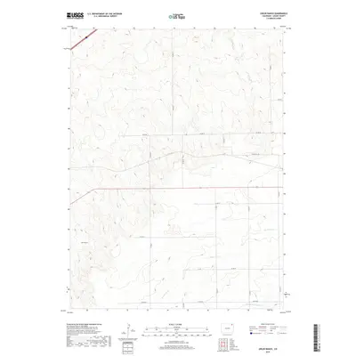
2019 Map of Uhler Ranch
USGS Topo · Published 2019About this map
Uhler Ranch stands as a focal point in this Logan County landscape, situated within a vast network of section lines and rural tracks. The terrain is defined by the ephemeral flow of Wildhorse Cr, which meanders across the central and eastern sections, and N Fork Frenchman Cr along the southern margin. This 2019 survey illustrates the enduring township and range system, with the intersections of Co RD 67, Co RD 38, and Co RD 71 creating a rigid geometry over the undulating high plains. The map preserves the specific spatial arrangement of local agriculture and water management, showing how the drainage of Wildhorse Cr interacts with the maintained county road grid in a region primarily dedicated to ranching and dryland operations.
Find a feature on this map
22 named features on this map. Tap any name to fly to it.
Don’t see what you’re looking for? This feature index may not catch every label — zoom into the map to look around manually.
Map Details
Editions of this 2019 Uhler Ranch Map
This is the sole edition of this map. No revisions or reprints were ever made.
Other maps of this area

1951 · Reiradon Hill
USGS Topo · 1:24,000

1951 · Galien
USGS Topo · 1:24,000

1951 · Iliff
USGS Topo · 1:24,000

1953 · Crook
USGS Topo · 1:24,000

1953 · Proctor
USGS Topo · 1:24,000

1954 · Sterling
USGS Topo · 1:250,000

1958 · Sterling
USGS Topo · 1:250,000

1962 · Fleming
USGS Topo · 1:24,000

1962 · Uhler Ranch
USGS Topo · 1:24,000

1972 · St Petersburg
USGS Topo · 1:24,000