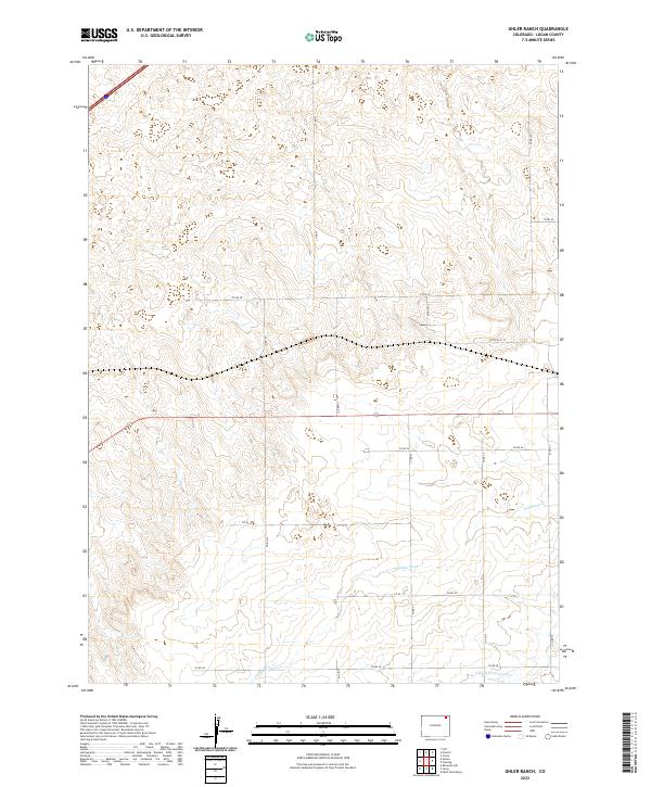
2022 Map of Uhler Ranch
USGS Topo · Published 2022About this map
Wildhorse Cr and N-Fork-Frenchman Cr carve subtle paths through this high plains landscape in Logan County, where the topography is defined by the rigid grid of the Public Land Survey System. The map centers on the t8n r50w and t9n r50w townships, showing a rural environment dominated by ranching and local transportation networks. A series of county roads, including Co Rd 67, Co Rd 69, and Co Rd 28, provide the primary infrastructure through the rolling terrain, tracing the section lines that have governed land division in this part of Colorado for over a century. The absence of dense town sites highlights the expansive, open nature of this ranching country, where the value for researchers lies in tracing specific land parcels and water rights along the intermittent creek beds.
Find a feature on this map
18 named features on this map. Tap any name to fly to it.
Don’t see what you’re looking for? This feature index may not catch every label — zoom into the map to look around manually.
Map Details
Editions of this 2022 Uhler Ranch Map
This is the sole edition of this map. No revisions or reprints were ever made.
Other maps of this area

1951 · Reiradon Hill
USGS Topo · 1:24,000

1951 · Galien
USGS Topo · 1:24,000

1951 · Iliff
USGS Topo · 1:24,000

1953 · Crook
USGS Topo · 1:24,000

1953 · Proctor
USGS Topo · 1:24,000

1954 · Sterling
USGS Topo · 1:250,000

1958 · Sterling
USGS Topo · 1:250,000

1962 · Fleming
USGS Topo · 1:24,000

1962 · Uhler Ranch
USGS Topo · 1:24,000

1972 · St Petersburg
USGS Topo · 1:24,000