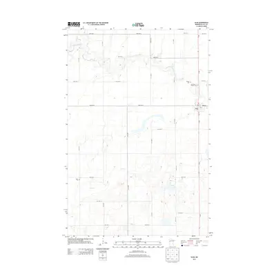
2013 Map of Ulen
USGS Topo · Published 2013About this map
Ulen anchors the eastern edge of this landscape in Clay County, serving as a primary settlement node along the MN-32 corridor. The town layout is clearly defined, featuring a central Po and residential blocks that give way to a vast agricultural grid. Outside of the town center, the terrain is shaped by the winding course of the S Br Wild Rice River in the north and the meandering Felton Cr further south, both cutting through a meticulously surveyed network of section roads like 190th Ave N and 250th St N.
Find a feature on this map
24 named features on this map. Tap any name to fly to it.
Don’t see what you’re looking for? This feature index may not catch every label — zoom into the map to look around manually.
Map Details
Editions of this 2013 Ulen Map
This is the sole edition of this map. No revisions or reprints were ever made.
Other maps of this area

1918 · Flom
USGS Topo · 1:62,500

1918 · Ulen
USGS Topo · 1:62,500

1919 · Hawley
USGS Topo · 1:62,500

1952 · Grand Forks
USGS Topo · 1:250,000

1953 · Fargo
USGS Topo · 1:250,000

1956 · Fargo
USGS Topo · 1:250,000

1956 · Grand Forks
USGS Topo · 1:250,000

1965 · Syre
USGS Topo · 1:24,000
1965 · Ulen NW
USGS Topo · 1:24,000

1966 · Flom
USGS Topo · 1:24,000