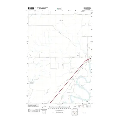
2011 Map of Ulm
USGS Topo · Published 2011About this map
The Missouri River meanders through the southeastern portion of this landscape, defining the local geography as it flows past the community of Ulm. This settlement serves as a focal point, featuring the Ulm Post Office and the Ulm Vol Fire Company near the Ulm Bridge. The surrounding terrain transitions into the broad Ulm Flats, a level expanse punctuated by water management infrastructure such as the W C Eustance Number 1 Dam and Dry Fork Fairhaven Number 2 Dam.
Find a feature on this map
39 named features on this map. Tap any name to fly to it.
Don’t see what you’re looking for? This feature index may not catch every label — zoom into the map to look around manually.
Map Details
Editions of this 2011 Ulm Map
This is the sole edition of this map. No revisions or reprints were ever made.
Other maps of this area

1886 · Great Falls
USGS Topo · 1:250,000

1949 · Cascade
USGS Topo · 1:62,500

1949 · Great Falls
USGS Topo · 1:62,500

1949 · Vaughn
USGS Topo · 1:62,500

1951 · Great Falls
USGS Topo · 1:62,500

1951 · Cascade
USGS Topo · 1:62,500

1952 · Vaughn
USGS Topo · 1:62,500

1954 · Great Falls
USGS Topo · 1:250,000

1955 · Gore Hill
USGS Topo · 1:62,500

1957 · Great Falls
USGS Topo · 1:250,000