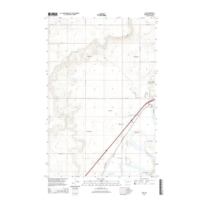
2014 Map of Ulm
USGS Topo · Published 2014About this map
The Missouri River carves a path through the heart of Cascade County in this 2014 survey, defining the agricultural and transport corridor surrounding Ulm. The township is anchored by the crossing at Ulm Bridge and the extensive Ulm Flats to the west. This landscape is shaped by the transition from the elevated Sun River Bench and Taft Hill in the north down to the riparian bottomlands where the Muddy Creek Slough joins the river.
Find a feature on this map
39 named features on this map. Tap any name to fly to it.
Don’t see what you’re looking for? This feature index may not catch every label — zoom into the map to look around manually.
Map Details
Editions of this 2014 Ulm Map
This is the sole edition of this map. No revisions or reprints were ever made.
Other maps of this area

1886 · Great Falls
USGS Topo · 1:250,000

1949 · Cascade
USGS Topo · 1:62,500

1949 · Great Falls
USGS Topo · 1:62,500

1949 · Vaughn
USGS Topo · 1:62,500

1951 · Great Falls
USGS Topo · 1:62,500

1951 · Cascade
USGS Topo · 1:62,500

1952 · Vaughn
USGS Topo · 1:62,500

1954 · Great Falls
USGS Topo · 1:250,000

1955 · Gore Hill
USGS Topo · 1:62,500

1957 · Great Falls
USGS Topo · 1:250,000