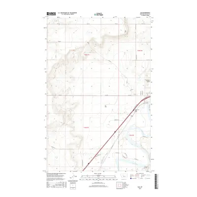
2017 Map of Ulm
USGS Topo · Published 2017About this map
The Missouri River and Sun River converge in this section of Cascade County, defining a landscape of broad terraces and high ground. The settlement of Ulm serves as the focal point, positioned near the Muddy Creek Slough Bridge and the historical crossing at Ulm Bridge. To the north, the terrain rises sharply toward the Sun River Bench and Taft Hill, while the expansive Ulm Flats occupy the central lowlands. Local genealogy and land use are etched into the map via numerous rural routes like Luebbe Rd and Polish Rd, alongside the Ulm Cem. This survey illustrates the modern road network, including the Ulm N Frontage Rd, which runs parallel to the primary transit corridor, contrasted by older thoroughfares such as Old US Hwy 91 and Old Ulm Cascade Rd.
Find a feature on this map
41 named features on this map. Tap any name to fly to it.
Don’t see what you’re looking for? This feature index may not catch every label — zoom into the map to look around manually.
Map Details
Editions of this 2017 Ulm Map
This is the sole edition of this map. No revisions or reprints were ever made.
Other maps of this area

1886 · Great Falls
USGS Topo · 1:250,000

1949 · Cascade
USGS Topo · 1:62,500

1949 · Great Falls
USGS Topo · 1:62,500

1949 · Vaughn
USGS Topo · 1:62,500

1951 · Great Falls
USGS Topo · 1:62,500

1951 · Cascade
USGS Topo · 1:62,500

1952 · Vaughn
USGS Topo · 1:62,500

1954 · Great Falls
USGS Topo · 1:250,000

1955 · Gore Hill
USGS Topo · 1:62,500

1957 · Great Falls
USGS Topo · 1:250,000