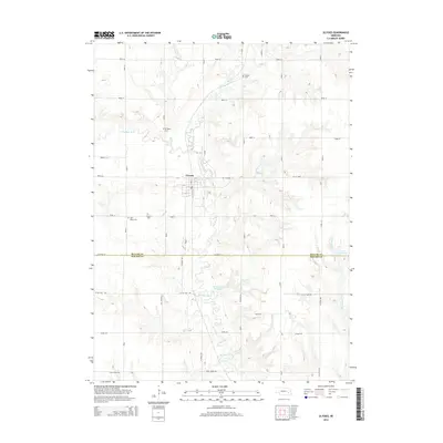
2014 Map of Ulysses
USGS Topo · Published 2014About this map
Ulysses serves as the central hub of this agricultural landscape, situated along the winding course of the Big Blue River and its tributary, the N Br Big Blue River. The map documents a rural corridor spanning the Butler Co and Seward Co line, where the section-line road grid is occasionally broken by the river's meandering path. Genealogists will find significant local history preserved in several family and community burial sites, including Saint Marys Cem, Ulysses Cem, and the more outlying Karpisek Cem and Grimm Cem. The presence of water management features like Kratochvil Reservoir and Morovec Reservoir illustrates the region's reliance on irrigation and local hydrology. This 2014 survey records the established network of county roads, such as Little Salt Rd and Agnew Rd, that define the spatial organization of these Nebraska plains.
Find a feature on this map
35 named features on this map. Tap any name to fly to it.
Don’t see what you’re looking for? This feature index may not catch every label — zoom into the map to look around manually.
Map Details
Editions of this 2014 Ulysses Map
This is the sole edition of this map. No revisions or reprints were ever made.
Other maps of this area

1899 · David City
USGS Topo · 1:125,000

1934 · Seward
USGS Topo · 1:48,000

1934 · Utica
USGS Topo · 1:62,500

1937 · Utica
USGS Topo · 1:62,500

1939 · Seward
USGS Topo · 1:62,500

1955 · Fremont
USGS Topo · 1:250,000

1955 · Lincoln
USGS Topo · 1:250,000

1957 · Fremont
USGS Topo · 1:250,000

1957 · Lincoln
USGS Topo · 1:250,000

1958 · Fremont
USGS Topo · 1:250,000