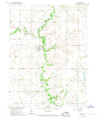
1966 Map of Ulysses
USGS Topo · Published 1967About this map
Ulysses serves as the focal point of this mid-1960s study, situated at the confluence of the Big Blue River and its North Branch. The village is organized around the Chicago Burlington and Quincy railroad, which cuts through the river valley, supporting the agricultural economy of the Butler and Seward County border. This survey was conducted as part of a Department of the Interior program for the development of the Missouri River Basin, detailing a landscape defined by sharp topographical changes between upland farm plots and the winding river bottomlands.
Find a feature on this map
15 named features on this map. Tap any name to fly to it.
Don’t see what you’re looking for? This feature index may not catch every label — zoom into the map to look around manually.
Map Details
Editions of this 1966 Ulysses Map
This is the sole edition of this map. No revisions or reprints were ever made.
Other maps of this area

1899 · David City
USGS Topo · 1:125,000

1934 · Seward
USGS Topo · 1:48,000

1934 · Utica
USGS Topo · 1:62,500

1937 · Utica
USGS Topo · 1:62,500

1939 · Seward
USGS Topo · 1:62,500

1955 · Fremont
USGS Topo · 1:250,000

1955 · Lincoln
USGS Topo · 1:250,000

1957 · Fremont
USGS Topo · 1:250,000

1957 · Lincoln
USGS Topo · 1:250,000

1958 · Fremont
USGS Topo · 1:250,000