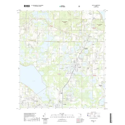
2021 Map of Umatilla
USGS Topo · Published 2021About this map
Umatilla and the surrounding Lake County citrus and lake country are captured here at the beginning of the 2020s. This landscape is defined by its numerous named water bodies, ranging from the expansive Lake Yale on the western edge to smaller interior basins like Lake Enola and Lake Geneva. The map provides a detailed look at the interface between the Ocala National Forest to the north and the established residential corridors extending from Eustis northward through Dona Vista and Altoona.
Find a feature on this map
170 named features on this map. Tap any name to fly to it.
Don’t see what you’re looking for? This feature index may not catch every label — zoom into the map to look around manually.
Map Details
Editions of this 2021 Umatilla Map
This is the sole edition of this map. No revisions or reprints were ever made.
Other maps of this area

1954 · Daytona Beach
USGS Topo · 1:250,000

1955 · Orlando
USGS Topo · 1:250,000

1957 · Orlando
USGS Topo · 1:250,000

1958 · Orlando
USGS Topo · 1:250,000

1958 · Daytona Beach
USGS Topo · 1:250,000

1960 · Sorrento
USGS Topo · 1:24,000

1962 · Orlando
USGS Topo · 1:250,000

1964 · Daytona Beach
USGS Topo · 1:250,000

1965 · Leesburg East
USGS Topo · 1:24,000

1965 · Umatilla
USGS Topo · 1:24,000