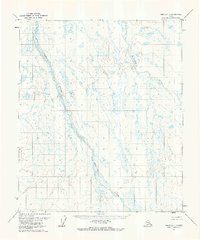
1971 Map of Umiat A-1
USGS Topo · Published 1973About this map
The Itkillik River meanders across this northern landscape, defining the western drainage of a region characterized by vast swampy lowlands and complex hydrologic patterns. To the east, the Kuparuk River follows a parallel course through the tundra, with both waterways showing the characteristic braided and shifting channels of the Arctic slope. A solitary Landing Strip situated along the Itkillik River serves as the primary evidence of human infrastructure in this remote area. Mapped via aerial photography taken in 1970 and field-annotated in 1971, the survey captures the terrain just as northern resource exploration was intensifying. The map highlights the seasonal nature of the landscape, noting that swamps portray only the wetter areas of low relief as interpreted from the 1970 photography.
Find a feature on this map
3 named features on this map. Tap any name to fly to it.
Don’t see what you’re looking for? This feature index may not catch every label — zoom into the map to look around manually.
Map Details
Editions of this 1971 Umiat A-1 Map
This is the sole edition of this map. No revisions or reprints were ever made.
Other maps of this area

1951 · Sagavanirktok D-5
USGS Topo · 1:250,000

1951 · Chandler Lake
USGS Topo · 1:250,000

1951 · Brooks
USGS Topo · 1:250,000

1952 · Umiat
USGS Topo · 1:250,000

1956 · Philip Smith Mountains
USGS Topo · 1:250,000

1956 · Chandler Lake
USGS Topo · 1:250,000

1956 · Sagavanirktok
USGS Topo · 1:250,000

1956 · Umiat
USGS Topo · 1:250,000

1958 · Sagavanirktok
USGS Topo · 1:250,000

1964 · Philip Smith Mountains
USGS Topo · 1:250,000