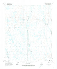
1971 Map of Umiat B-1
USGS Topo · Published 1974About this map
The Kuparuk River and Itkillik River dominate this 1970s landscape of the North Slope, revealing a terrain defined by seasonal movement and remote access. While the land remained largely unsurveyed and unmarked by the Bureau of Land Management at the time of this study, human activity is etched into the landscape through a network of specialized transportation routes. A Winter Road and Winter Trail crisscross the tundra, reflecting the necessity of frozen ground for overland travel in this region. The inclusion of a Landing Strip near the river bank suggests the importance of bush aviation for supply and survey work. This map records the Arctic prior to the full expansion of modern permanent infrastructure, where passage was dictated by the river systems and the seasonal shift between marsh and ice.
Find a feature on this map
6 named features on this map. Tap any name to fly to it.
Don’t see what you’re looking for? This feature index may not catch every label — zoom into the map to look around manually.
Map Details
Editions of this 1971 Umiat B-1 Map
This is the sole edition of this map. No revisions or reprints were ever made.
Other maps of this area

1951 · Sagavanirktok D-5
USGS Topo · 1:250,000

1952 · Umiat
USGS Topo · 1:250,000

1956 · Sagavanirktok
USGS Topo · 1:250,000

1956 · Umiat
USGS Topo · 1:250,000

1958 · Sagavanirktok
USGS Topo · 1:250,000

1964 · Umiat
USGS Topo · 1:250,000

1964 · Sagavanirktok
USGS Topo · 1:250,000
1971 · Umiat C-1
USGS Topo · 1:63,360

1971 · Umiat A-2
USGS Topo · 1:63,360
1971 · Sagavanirktok A-5
USGS Topo · 1:63,360