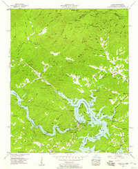
1957 Map of Unaka
USGS Topo · Published 1958About this map
Hiwassee Dam stands as the central engineering landmark of this landscape, controlling the waters of Hiwassee Lake where the river winds through the Unicoi Mountains. This late-1950s survey captures a transition between the wilder forest lands of the Cherokee National Forest and the industrial management of the Tennessee Valley Authority. Small riverside and mountain communities like Violet, Unaka, and Hiwassee Village are depicted alongside family burial grounds such as Lenderman Cem and Garrett Cem. The map traces the rugged path of the Joe Brown Highway as it cuts across the high ridges, including Long Ridge and Beaverdam Ridge. Downstream, the Apalachia Lake begins at the foot of the dam, illustrating the coordinated system of water control and power generation that reshaped this portion of the borderlands between North Carolina and Tennessee.
Find a feature on this map
99 named features on this map. Tap any name to fly to it.
Don’t see what you’re looking for? This feature index may not catch every label — zoom into the map to look around manually.
Map Details
Editions of this 1957 Unaka Map
3 editions found
Other maps of this area

1893 · Murphy
USGS Topo · 1:125,000

1914 · Murphy
USGS Topo · 1:125,000

1927 · Big Junction
USGS Topo · 1:24,000

1933 · Haw Knob
USGS Topo · 1:48,000

1933 · Bald River Falls
USGS Topo · 1:24,000

1934 · Murphy
USGS Topo · 1:24,000

1934 · Persimmon Creek
USGS Topo · 1:24,000

1934 · McDaniel Bald
USGS Topo · 1:24,000

1934 · Unaka
USGS Topo · 1:24,000

1934 · Murphy
USGS Topo · 1:48,000