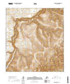
2017 Map of Unalakleet B-5 SE
USGS Topo · Published 2017About this map
Golsovia River dominates this interior portion of the Nome Census Area, carving a distinct valley through the northern Alaskan wilderness. The terrain is characterized by steep, closely spaced contour lines that reveal the high-elevation ridges typical of the Seward Peninsula’s transition toward the Norton Sound coast. In the southeastern corner, the headwaters of Otter Creek emerge from the high ground, providing a vital drainage point for the surrounding highlands. This 2017 survey reflects the vast, undeveloped character of the region, where the landscape is defined by its natural watercourses rather than human infrastructure or settlements. The lack of roads or established buildings underscores the area's isolation, making it a focused study of subarctic topography and the pristine drainage patterns of the Golsovia River system.
Find a feature on this map
10 named features on this map. Tap any name to fly to it.
Don’t see what you’re looking for? This feature index may not catch every label — zoom into the map to look around manually.
Map Details
Editions of this 2017 Unalakleet B-5 SE Map
This is the sole edition of this map. No revisions or reprints were ever made.
Other maps of this area

1951 · Unalakleet
USGS Topo · 1:250,000

1952 · Unalakleet A-4
USGS Topo · 1:63,360

1952 · Unalakleet A-5
USGS Topo · 1:63,360

1952 · Unalakleet B-4
USGS Topo · 1:63,360

1952 · Unalakleet B-5
USGS Topo · 1:63,360

1952 · Unalakleet
USGS Topo · 1:250,000

1964 · Unalakleet
USGS Topo · 1:250,000
2016 · Unalakleet A-4 NW
USGS Topo · 1:25,000
2016 · Unalakleet B-4 NW
USGS Topo · 1:25,000
2016 · Unalakleet B-4 SW
USGS Topo · 1:25,000