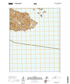
2020 Map of Unalaska C-1 NE
USGS Topo · Published 2020About this map
Unalga Island dominates the northern portion of this maritime survey, situated where the Bering Sea meets the North Pacific Ocean. This remote archipelago landscape is defined by its isolation and the naming of small landmasses such as the Baby Islands, which include features with Unangan (Aleut) labels like Tan'gaagamax, Ixsaxsxin, and Tan'gan. The cartography documents the transition between the Aleutians East Borough and Aleutians West Census Area, marked by a boundary line crossing the open water. Navigational channels like Baby Pass and Akutan Pass suggest the maritime movement required to traverse these island chains. The map provides a look at the topographical contours of these uninhabited landforms, preserving indigenous place names like Qyanan and Qusilxtax alongside broader maritime descriptors.
Find a feature on this map
17 named features on this map. Tap any name to fly to it.
Don’t see what you’re looking for? This feature index may not catch every label — zoom into the map to look around manually.
Map Details
Editions of this 2020 Unalaska C-1 NE Map
This is the sole edition of this map. No revisions or reprints were ever made.
Other maps of this area

1951 · Unalaska
USGS Topo · 1:250,000

1951 · Unimak
USGS Topo · 1:250,000

1958 · Unimak
USGS Topo · 1:250,000

1989 · Unimak A-6
USGS Topo · 1:63,360
1989 · Unalaska D-1
USGS Topo · 1:63,360
1989 · Unalaska C-1
USGS Topo · 1:63,360
2020 · Unalaska D-1 SW
USGS Topo · 1:25,000
2020 · Unalaska C-1 NW
USGS Topo · 1:25,000
2020 · Unimak A-6 SW
USGS Topo · 1:25,000
2020 · Unalaska D-1 SE
USGS Topo · 1:25,000