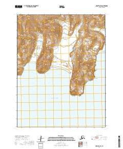
2020 Map of Unimak A-6 SW
USGS Topo · Published 2020About this map
Pacific Ocean swells meet the southern coastline of Unimak Island in this topographic study of the Aleutians East Borough. The landscape is defined by its dramatic maritime interface, where the shore transitions from the sheltered waters of Cascade Bight and Broad Bight into the steep coastal elevations of Angiididax and the prominent protrusion of Battery Point. This map illustrates a remote wilderness where landforms are the primary identifiers, showing no roads or permanent settlements in this specific coastal section. The contours reveal a complex drainage system and high-relief terrain that characterizes the volcanic nature of the Aleutian chain, providing a clear record of the island's natural geography as it stood in the early twenty-first century.
Find a feature on this map
9 named features on this map. Tap any name to fly to it.
Don’t see what you’re looking for? This feature index may not catch every label — zoom into the map to look around manually.
Map Details
Editions of this 2020 Unimak A-6 SW Map
This is the sole edition of this map. No revisions or reprints were ever made.
Other maps of this area

1951 · Unalaska
USGS Topo · 1:250,000

1951 · Unimak
USGS Topo · 1:250,000

1958 · Unimak
USGS Topo · 1:250,000

1989 · Unimak A-6
USGS Topo · 1:63,360
1989 · Unalaska D-1
USGS Topo · 1:63,360
1989 · Unalaska C-1
USGS Topo · 1:63,360
2020 · Unalaska D-1 NE
USGS Topo · 1:25,000
2020 · Unalaska C-1 NE
USGS Topo · 1:25,000
2020 · Unimak A-6 SE
USGS Topo · 1:25,000
2020 · Unimak A-6 NW
USGS Topo · 1:25,000