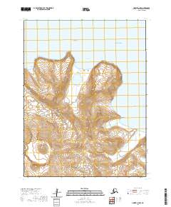
2020 Map of Unimak A-6 NW
USGS Topo · Published 2020About this map
Akutan Peak dominates the southern landscape of this coastal survey, where the dramatic elevation of Akutan Island meets the Bering Sea. Situated within the Fox Islands chain of the Aleutian Islands, the topography transitions from high volcanic summits to a deeply indented shoreline. Named coastal points such as North Head and Asugax define the northern maritime approach, while Open Bight provides a broad indentation along the coastline. On the eastern shore, Hot Springs Bay suggests geothermal activity characteristic of the Krenitzin Islands region. Several indigenous place names, including Usmichix, Jikux, and Almigin, remain on the land, marking the cultural and geographic identity of this isolated volcanic terrain.
Find a feature on this map
17 named features on this map. Tap any name to fly to it.
Don’t see what you’re looking for? This feature index may not catch every label — zoom into the map to look around manually.
Map Details
Editions of this 2020 Unimak A-6 NW Map
This is the sole edition of this map. No revisions or reprints were ever made.
Other maps of this area

1951 · Unalaska
USGS Topo · 1:250,000

1951 · Unimak
USGS Topo · 1:250,000

1958 · Unimak
USGS Topo · 1:250,000

1989 · Unimak A-6
USGS Topo · 1:63,360
1989 · Unalaska D-1
USGS Topo · 1:63,360
1989 · Unimak B-6
USGS Topo · 1:63,360
2020 · Unalaska D-1 NE
USGS Topo · 1:25,000
2020 · Unimak B-6 SE
USGS Topo · 1:25,000
2020 · Unimak A-6 SW
USGS Topo · 1:25,000
2020 · Unimak A-6 SE
USGS Topo · 1:25,000