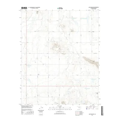
2016 Map of Unap Mountain
USGS Topo · Published 2016About this map
Unap Mountain rises as a central landmark in this portion of Kiowa County, where the landscape is defined by a series of distinct peaks and a complex network of water management sites. The small settlement of Sedan sits in the northeastern reaches, connected to the surrounding ranching and farming land by a strictly gridded system of section-line roads, including E1410 Rd and N2370 Rd. This modern survey illustrates the importance of water conservation in the region, featuring several numbered reservoirs such as Rainy Mountain Creek Site 6 Reservoir and Rainy Mountain Creek Site 13 Reservoir along the winding course of Rainy Mountain Creek. Local history is anchored by the Union Dale Cem in the southwest and the presence of the Jennings Ranch Airport, reflecting the continued importance of large-scale landholdings and private aviation in rural Oklahoma. The terrain transitions from the heights of Rainy Mountain and Longhorn Mountain down into the drainages of Sugar Creek and Longhorn Creek.
Find a feature on this map
30 named features on this map. Tap any name to fly to it.
Don’t see what you’re looking for? This feature index may not catch every label — zoom into the map to look around manually.
Map Details
Editions of this 2016 Unap Mountain Map
This is the sole edition of this map. No revisions or reprints were ever made.
Other maps of this area

1949 · Cooperton
USGS Topo · 1:62,500

1950 · Saddle Mountain
USGS Topo · 1:62,500

1955 · Lawton
USGS Topo · 1:250,000

1955 · Clinton
USGS Topo · 1:250,000

1956 · Glen Mountains
USGS Topo · 1:24,000

1956 · Saddle Mountain
USGS Topo · 1:24,000

1956 · Cooperton
USGS Topo · 1:24,000

1956 · Bally Mountain
USGS Topo · 1:24,000

1956 · Unap Mountain
USGS Topo · 1:24,000

1956 · Rainy Mountain Creek
USGS Topo · 1:24,000