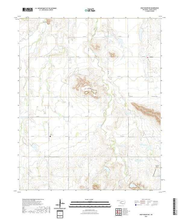
2022 Map of Unap Mountain
USGS Topo · Published 2022About this map
Unap Mtn and the surrounding plains of Kiowa County define this corner of Oklahoma, where the landscape is marked by isolated peaks rising from the agricultural grid. The small settlement of Sedan sits at the northern edge of the map, served by a network of sectional roads like e1410 RD. A significant series of water management projects are visible across the terrain, including numerous reservoirs such as Rainy Mountain Cr Site 6 Reservoir and Rainy Mountain Cr Site 13 Reservoir, which capture runoff from the area's namesake creeks. For those researching local burial sites or family history, the Union Dale Cem is located centrally between the mountain peaks. The presence of the Jennings Ranch Airport near Longhorn Cr reflects the modern ranching and aviation infrastructure that characterizes this rural area.
Find a feature on this map
35 named features on this map. Tap any name to fly to it.
Don’t see what you’re looking for? This feature index may not catch every label — zoom into the map to look around manually.
Map Details
Editions of this 2022 Unap Mountain Map
This is the sole edition of this map. No revisions or reprints were ever made.
Other maps of this area

1949 · Cooperton
USGS Topo · 1:62,500

1950 · Saddle Mountain
USGS Topo · 1:62,500

1955 · Lawton
USGS Topo · 1:250,000

1955 · Clinton
USGS Topo · 1:250,000

1956 · Glen Mountains
USGS Topo · 1:24,000

1956 · Saddle Mountain
USGS Topo · 1:24,000

1956 · Cooperton
USGS Topo · 1:24,000

1956 · Bally Mountain
USGS Topo · 1:24,000

1956 · Unap Mountain
USGS Topo · 1:24,000

1956 · Rainy Mountain Creek
USGS Topo · 1:24,000