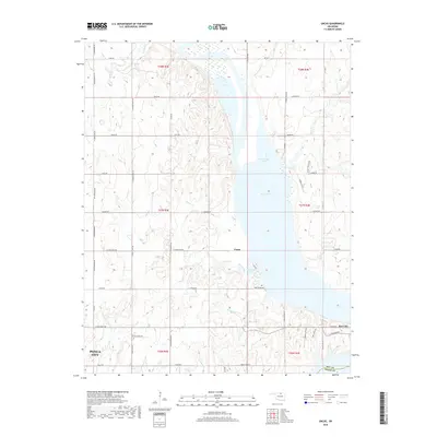
2018 Map of Uncas
USGS Topo · Published 2018About this map
The waters of Kaw Lake dominate the eastern landscape of this Kay County region, where the reservoir has reshaped the original topography near the Kay and Osage County boundary. The settlement of Uncas sits just west of the lake's central reach, positioned near the drainage of Coon Creek and its namesake Coon Creek Cove. Further south, the map captures the northern outskirts of Kaw City and the northeastern corner of Ponca City, connected by a grid of rural routes like Kildare Rd and E Coleman Rd. The area’s cemetery record is represented by Oak Grove Cem, located on a rise overlooking the water. Local drainage is defined by numerous small tributaries including Possum Creek, Wildcat Creek, and Sweetwater Creek, which carve through the terrain before meeting the reservoir.
Find a feature on this map
61 named features on this map. Tap any name to fly to it.
Don’t see what you’re looking for? This feature index may not catch every label — zoom into the map to look around manually.
Map Details
Editions of this 2018 Uncas Map
This is the sole edition of this map. No revisions or reprints were ever made.
Other maps of this area

1935 · Kaw
USGS Topo · 1:62,500

1936 · Belford
USGS Topo · 1:62,500

1955 · Enid
USGS Topo · 1:250,000

1958 · Enid
USGS Topo · 1:250,000

1963 · Charley Creek
USGS Topo · 1:24,000

1963 · Uncas
USGS Topo · 1:24,000

1963 · Kaw City NW
USGS Topo · 1:24,000

1964 · Charley Creek NE
USGS Topo · 1:24,000

1964 · Kaw City
USGS Topo · 1:24,000
1964 · Hardy
USGS Topo · 1:24,000