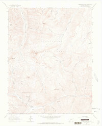
1964 Map of Uncompahgre Peak
USGS Topo · Published 1966About this map
Capitol City sits as a remnant of a silver-mining era on the banks of Henson Creek in the mid-1960s. Located within the Uncompahgre National Forest, this high-altitude landscape is characterized by its legacy of mineral extraction, with numerous workings like the Pride of America Mine and Silver Jack Mine dotting the drainages. The topography is defined by prominent summits including Uncompahgre Peak and Matterhorn Peak, which rise above a network of pack trails and jeep trails that once served as the primary routes for ore transport. The presence of Yellowstone Creek, Nellie Creek, and the East Fork Cimarron River highlights the complex hydrology of the San Juan Mountains, where steep gulches such as Big Casino Gulch and Copper Gulch funnel snowmelt toward the valley floors. This survey documents the transition of the area from an active mining district to a rugged landscape of recreational trails and geologic study.
Find a feature on this map
43 named features on this map. Tap any name to fly to it.
Don’t see what you’re looking for? This feature index may not catch every label — zoom into the map to look around manually.
Map Details
Editions of this 1964 Uncompahgre Peak Map
This is the sole edition of this map. No revisions or reprints were ever made.
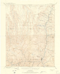
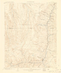
Other maps of this area

1897 · Silverton
USGS Topo · 1:62,500

1901 · Silverton
USGS Topo · 1:62,500

1902 · Silverton
USGS Topo · 1:62,500

1902 · Ouray
USGS Topo · 1:62,500
1903 · Lake City
USGS Topo · 1:62,500

1904 · Ouray
USGS Topo · 1:62,500
1905 · Lake City
USGS Topo · 1:62,500

1905 · San Cristobal
USGS Topo · 1:125,000

1907 · San Cristobal
USGS Topo · 1:125,000

1908 · Uncompahgre
USGS Topo · 1:125,000