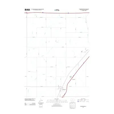
2013 Map of Underwood
USGS Topo · Published 2013About this map
Underwood serves as the primary hub of this Pottawattamie County landscape, situated where local street grids like 1st St and Faith Ave meet the modern regional thoroughfares. The terrain is defined by a dense network of drainage systems, including Pigeon Cr, Onion Cr, and Mosquito Cr, which weave between a strictly organized grid of agricultural roads. These routes, often bearing botanical names such as Whippoorwill Rd, Sycamore Rd, and Magnolia Rd, reflect the rural residential and farming character of the area. Significant local recreational and traveler infrastructure is also evident, notably the Quail Run Golf Course and the paired Underwood North Bound Rest Area and South Bound Rest Area, illustrating the intersection of local community life and interstate transit.
Find a feature on this map
42 named features on this map. Tap any name to fly to it.
Don’t see what you’re looking for? This feature index may not catch every label — zoom into the map to look around manually.
Map Details
Editions of this 2013 Underwood Map
This is the sole edition of this map. No revisions or reprints were ever made.
Other maps of this area

1893 · Omaha
USGS Topo · 1:62,500

1954 · Omaha
USGS Topo · 1:250,000

1956 · Underwood
USGS Topo · 1:24,000

1956 · Council Bluffs North
USGS Topo · 1:24,000

1956 · Neola
USGS Topo · 1:24,000

1956 · Mc Clelland
USGS Topo · 1:24,000

1957 · Omaha
USGS Topo · 1:250,000

1957 · Taylor
USGS Topo · 1:24,000

1957 · Honey Creek
USGS Topo · 1:24,000

1958 · Omaha
USGS Topo · 1:250,000