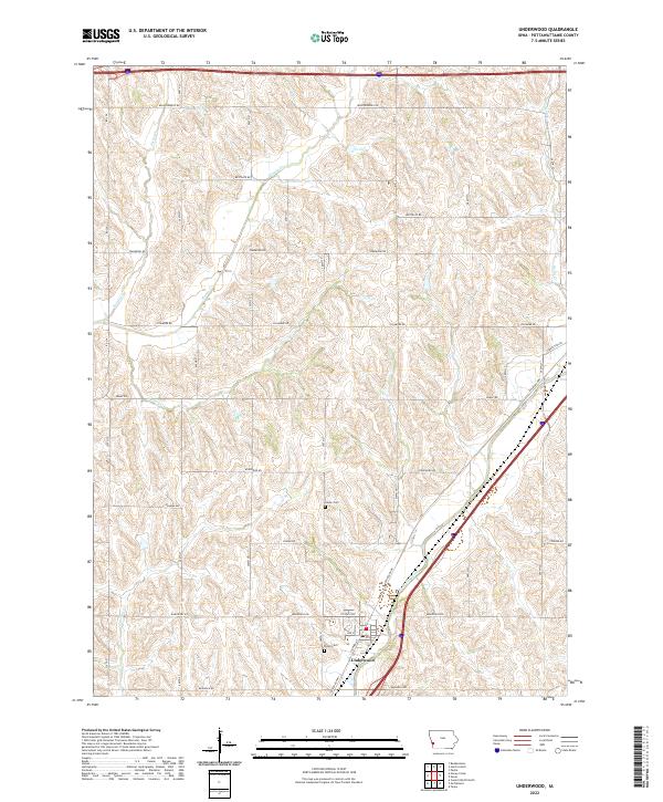
2022 Map of Underwood
USGS Topo · Published 2022About this map
Underwood serves as the primary hub of this Iowa landscape, situated where Railroad Hwy and Co Hwy G30 meet. The township is defined by a dense network of watercourses, with the prominent Mosquito Creek flowing through the southern sections while smaller tributaries like Pigeon Cr, Potato Cr, and Onion Cr carve through the surrounding agricultural sections. This drainage pattern reveals the intricate topography of the Missouri River watershed in this part of Pottawattamie County.
Find a feature on this map
39 named features on this map. Tap any name to fly to it.
Don’t see what you’re looking for? This feature index may not catch every label — zoom into the map to look around manually.
Map Details
Editions of this 2022 Underwood Map
This is the sole edition of this map. No revisions or reprints were ever made.
Other maps of this area

1893 · Omaha
USGS Topo · 1:62,500

1954 · Omaha
USGS Topo · 1:250,000

1956 · Underwood
USGS Topo · 1:24,000

1956 · Council Bluffs North
USGS Topo · 1:24,000

1956 · Neola
USGS Topo · 1:24,000

1956 · Mc Clelland
USGS Topo · 1:24,000

1957 · Omaha
USGS Topo · 1:250,000

1957 · Taylor
USGS Topo · 1:24,000

1957 · Honey Creek
USGS Topo · 1:24,000

1958 · Omaha
USGS Topo · 1:250,000