
1989 Map of Unimak A-6
USGS Topo · Published 1989About this map
Akutan Island dominates this 1980s topographic survey, showcasing the maritime landscape of the eastern Aleutians. The island's complex shoreline is defined by deep inlets such as Akutan Harbor and Hot Springs Bay, where steep terrain meets the waters of the Akutan Bay and the Bering Sea. To the south, Sarana Bay and Broad Bight face the Pacific Ocean, separated by the prominent Battery Point and Liberty Cap. This map documents a period before significant modern changes, recording the exact placement of navigational aids like the Light at North Head and Akutan Point. The landscape is characterized by its high volcanic peaks and coastal features, including Vulcan Point and Slide Talus Point, providing a detailed view of the island's geography within the Aleutians East Borough.
Find a feature on this map
25 named features on this map. Tap any name to fly to it.
Don’t see what you’re looking for? This feature index may not catch every label — zoom into the map to look around manually.
Map Details
Editions of this 1989 Unimak A-6 Map
This is the sole edition of this map. No revisions or reprints were ever made.
Other maps of this area

1951 · Unalaska
USGS Topo · 1:250,000

1951 · Unimak
USGS Topo · 1:250,000

1958 · Unimak
USGS Topo · 1:250,000
1989 · Unimak B-5
USGS Topo · 1:63,360
1989 · Unalaska D-1
USGS Topo · 1:63,360
1989 · Unimak B-6
USGS Topo · 1:63,360
1989 · Unalaska C-1
USGS Topo · 1:63,360
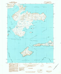
1989 · Unimak A-5
USGS Topo · 1:63,360
2020 · Unalaska D-1 NE
USGS Topo · 1:25,000
2020 · Unalaska C-1 NE
USGS Topo · 1:25,000