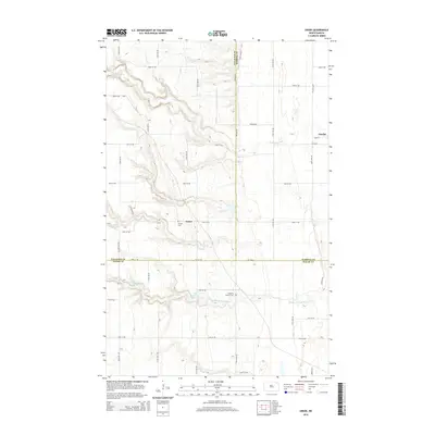
2014 Map of Union
USGS Topo · Published 2014About this map
Union and Gardar anchor this rural landscape where the boundaries of Cavalier, Pembina, and Walsh counties meet. The terrain is defined by the winding paths of the N Br Park River and the Middle Br Park River, which cut through the undulating plains of northeastern North Dakota. Local history is preserved at the W Zion Cem near Union and the Langemo Pioneer Cem further south along the river valley. The map reveals a highly structured grid of section-line roads, including Border Ave and 78th St NE, which facilitate movement across this agricultural region. Small water features like Lake Charlie dot the landscape, illustrating the drainage patterns that characterize the Park River watershed before the waters move toward the Red River Valley.
Find a feature on this map
33 named features on this map. Tap any name to fly to it.
Don’t see what you’re looking for? This feature index may not catch every label — zoom into the map to look around manually.
Map Details
Editions of this 2014 Union Map
This is the sole edition of this map. No revisions or reprints were ever made.
Other maps of this area

1952 · Thief River Falls
USGS Topo · 1:250,000

1953 · Devils Lake
USGS Topo · 1:250,000

1956 · Thief River Falls
USGS Topo · 1:250,000

1956 · Devils Lake
USGS Topo · 1:250,000

1957 · Thief River Falls
USGS Topo · 1:250,000

1963 · Edinburg
USGS Topo · 1:24,000

1963 · Gardar
USGS Topo · 1:24,000

1964 · Mountain
USGS Topo · 1:24,000
1964 · Concrete
USGS Topo · 1:24,000

1967 · Thief River Falls
USGS Topo · 1:250,000