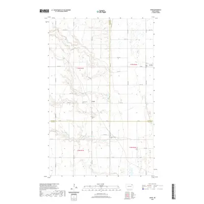
2020 Map of Union
USGS Topo · Published 2020About this map
The N Br Park River and its southern counterpart, the Middle Br Park River, define the undulating drainage patterns of this rural landscape where Cavalier, Walsh, and Pembina counties converge. This intersection of northern North Dakota prairie is anchored by the small settlement of Union and the community of Gardar on the eastern edge. The map captures a high concentration of pioneer-era burial grounds, reflecting the deep immigrant roots and early homesteading history of the region.
Find a feature on this map
29 named features on this map. Tap any name to fly to it.
Don’t see what you’re looking for? This feature index may not catch every label — zoom into the map to look around manually.
Map Details
Editions of this 2020 Union Map
This is the sole edition of this map. No revisions or reprints were ever made.
Other maps of this area

1952 · Thief River Falls
USGS Topo · 1:250,000

1953 · Devils Lake
USGS Topo · 1:250,000

1956 · Thief River Falls
USGS Topo · 1:250,000

1956 · Devils Lake
USGS Topo · 1:250,000

1957 · Thief River Falls
USGS Topo · 1:250,000

1963 · Edinburg
USGS Topo · 1:24,000

1963 · Gardar
USGS Topo · 1:24,000

1964 · Mountain
USGS Topo · 1:24,000
1964 · Concrete
USGS Topo · 1:24,000

1967 · Thief River Falls
USGS Topo · 1:250,000