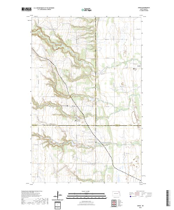
2024 Map of Union
USGS Topo · Published 2024About this map
Union and Gardar anchor this 2024 topographic landscape, where the flat agricultural plains of northeastern North Dakota are carved by the winding paths of the North Branch Park River and the Middle Branch Park River. The area is a nexus of early settlement history, evidenced by a high density of pioneer burial grounds that tell the story of the region's Scandinavian and Icelandic heritage. From the Gardar Pioneer Cem near the town center to the isolated West Zion Cem and Zion Lutheran Cem, these sites are preserved among a grid of section-line roads like Co Rd 1 and Co Hwy 1. The geography is defined by the subtle drainage patterns leading toward Lake Charlie, with the map clearly delineating the boundaries where Cavalier Co, Pembina Co, and Walsh Co meet.
Find a feature on this map
29 named features on this map. Tap any name to fly to it.
Don’t see what you’re looking for? This feature index may not catch every label — zoom into the map to look around manually.
Map Details
Editions of this 2024 Union Map
This is the sole edition of this map. No revisions or reprints were ever made.
Other maps of this area

1952 · Thief River Falls
USGS Topo · 1:250,000

1953 · Devils Lake
USGS Topo · 1:250,000

1956 · Thief River Falls
USGS Topo · 1:250,000

1956 · Devils Lake
USGS Topo · 1:250,000

1957 · Thief River Falls
USGS Topo · 1:250,000

1963 · Edinburg
USGS Topo · 1:24,000

1963 · Gardar
USGS Topo · 1:24,000

1964 · Mountain
USGS Topo · 1:24,000
1964 · Concrete
USGS Topo · 1:24,000

1967 · Thief River Falls
USGS Topo · 1:250,000