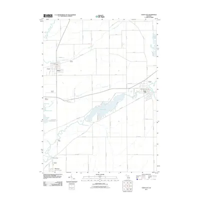
2011 Map of Union City
USGS Topo · Published 2011About this map
The Saint Joseph River and Union Lake dominate the southern half of this landscape, anchoring a regional geography where water and agriculture intersect. The village of Union City sits at a prominent bend in the river, while Athens and Sherwood serve as secondary hubs connected by a network of rural roads such as W DR S and Dunks RD. Local history is preserved in several burial grounds, including Riverside Cemetery near the riverbanks and Old Burg Cemetery situated north of the Athens settlement. The presence of Davids Airport and multiple post offices indicates a maintained infrastructure for transportation and communication. Small water bodies like Turtle Lake, Lehr Lake, and Kenyon Lake dot the terrain, while crossings at Studley Bridge and Little Bridge reflect the necessity of navigating the various creeks and river channels that defined movement through the county during this era.
Find a feature on this map
79 named features on this map. Tap any name to fly to it.
Don’t see what you’re looking for? This feature index may not catch every label — zoom into the map to look around manually.
Map Details
Editions of this 2011 Union City Map
This is the sole edition of this map. No revisions or reprints were ever made.
Other maps of this area

1918 · Union City
USGS Topo · 1:62,500

1918 · Leonidas
USGS Topo · 1:62,500

1944 · Leonidas
USGS Topo · 1:62,500

1947 · Union City
USGS Topo · 1:62,500

1947 · Leonidas
USGS Topo · 1:62,500

1950 · Leonidas
USGS Topo · 1:62,500

1950 · Union City
USGS Topo · 1:62,500

1953 · Fort Wayne
USGS Topo · 1:250,000

1956 · Fort Wayne
USGS Topo · 1:250,000

1958 · Grand Rapids
USGS Topo · 1:250,000